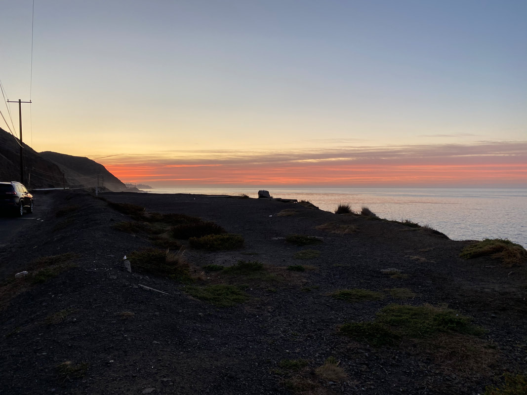
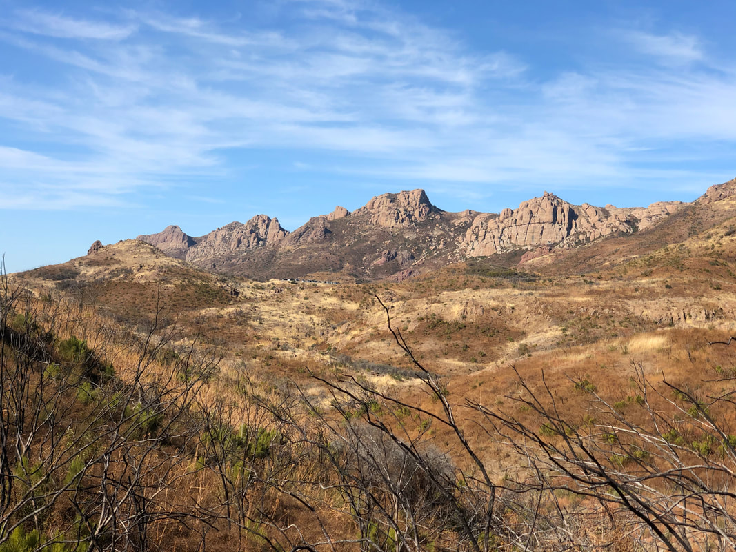
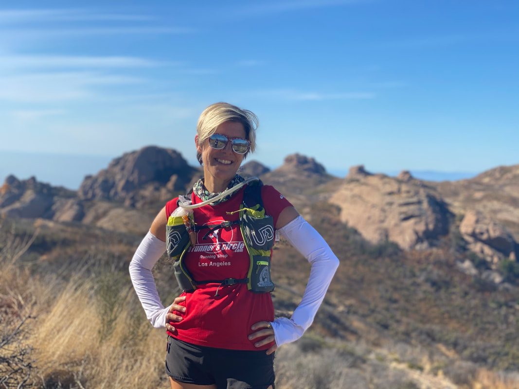
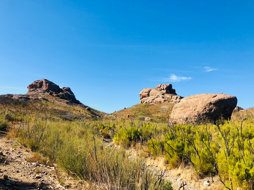
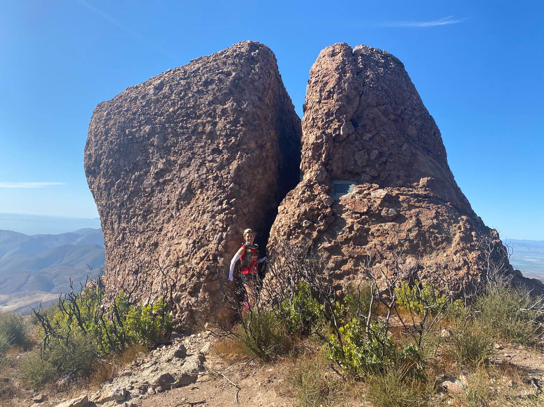
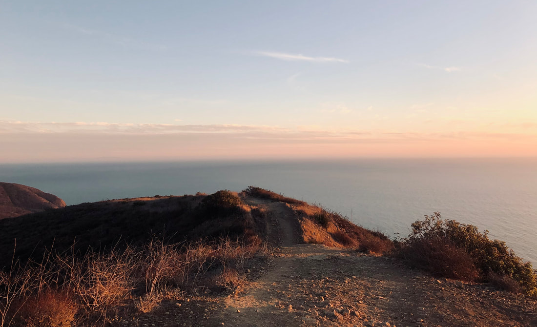
 The final stretch of my Backbone Trail adventure was this Sunday. If you haven't already read my first two posts, this was the third and final section of the Backbone Trail - a 68 mile trail that extends through the Santa Monica Mountains from Will Rogers Park in Pacific Palisades to La Jolla Canyon near Point Mugu. My friend and I divided up the trail into 3 sections and completed them on three consecutive Sundays - part 1 was Will Rogers to Piuma Road (23 miles); part 2 was Piuma Road to Encinal Canyon Road (20 miles); and part 3 would be Encinal Canyon Road to La Jolla Canyon (25 miles - though it actually logged in at 28 but more on that later). This final stretch was the farthest from my house and since we were dropping one car at the start and one at the finish, it required the most pre-hike commuting. The shorter days and our hike pace necessitated we have as much daylight as possible, so we opted to stay overnight in a nearby hotel, reducing our morning-of commute to only 45 minutes instead of nearly 2 hours. The logistics of taking all my gear and SCD meals to a hotel for an overnight stay were more complex and so this post will go into how I prepared.  Eager anticipation, dread, and a dash of what-was-I-thinking fueled my relentless need to organize and be properly prepared for part 3 of the Backbone. This 25 mile hike would take a predicted 9 hours, would have limited water on the course, and would require some climbs that made my legs tremble in advance. Since this was an "away-game" I had to be ultra organized in my preparation because you can't pop into the running store at 5am to replace a forgotten hat. The first two hikes had given me a good foundation on which to plan. I started off by printing up my food and gear list that I've been using since the first hike. I had found a formula that worked - gear and gut wise - and decided not to reinvent the wheel. Overpacking was not an option - the items I needed were ESSENTIAL for safety and comfort but I would only be in a hotel for 12 hours from 5pm to 5am so I didn't need much. I'd also be leaving my car at the trail head for multiple hours and didn't want big bags to entice any would be smash-and-grabbers. I needed food but I didn't want to waste any or leave anything in my car that would spoil or smell. So I wrote down a detailed "timeline" packing list that included exactly what I would wear during the 12 hour hotel stay, the hike, and the post-hike car drive. It also included exactly what I planned to eat for each meal while at the hotel, on the trail, and in the car post-hike. That included spaghetti squash with chicken and marinara for dinner; 2 hard boiled eggs and a banana for breakfast; spaghetti squash with marinara for post-hike (no meat that might spoil). We stayed at the Holiday Inn Express in Port Hueneme (just outside Oxnard) and it was really comfortable and safe. There was a small fridge, microwave, and a coffee maker in the room. It was also just 14 minutes from the La Jolla Canyon Trailhead which was 25 minutes from the Encinal Canyon Trailhead. We got up early and figured out which gear went in each car. We left at 5:45am and dropped off one car at La Jolla, the other we drove to Encinal Canyon. THE HIKE This last section of the hike was stunning - honestly the whole trail is, but this part had the most sweeping views of the ocean for a long time. The beginning of the hike started out mildly and we were able to keep a quick pace until we stopped for a snack at Yerba Buena Road. This parking lot had lots of room for cars so it's a good starting point for future hikes though it gets crowded. There was nowhere to sit and no shade so we ate a snack standing up. I'm glad we fueled up because this was the base of one of the most challenging climbs of the hike - the trail to Sandstone Peak, the highest peak in the Santa Monica Mountains at over 3000ft. This trail was no joke and neither was my heart rate. Despite being a cool day, the sun and steep incline over single track rocky trail made it feel 20 degrees hotter! My heart rate monitor was in the red zone as we climbed and I took a few breaks to "take in the views" and recalibrate my lungs. This trail is popular so we encountered many people on the trail. In stark contrast to the crowds at Sandstone was the next section that went by Split Rock. The trail was overgrown with dense bamboo type plants, narrow, and desolate. There were a few difficult miles trudging through but then the trail opened up and suddenly we were amongst the most spectacular rock formations, high above the sea and valley. Looking down, we could see the trail that we would be following, meandering distinctly through the shrubbery with an almost comical pattern of switchbacks. When we got down to the valley, looking up at those distinctive rocks was a mind-boggling testament to how far we'd come. Near Sycamore Canyon we found our first and only water stop at Danielson Ranch (mile 19 on this hike). There were picnic tables, shade, and porta-potties too. It was a wonderful place to have a longer snack break, wash our hands, and refill our water - and watch deer. It was also one of the lowest elevations of the hike and the calm before the final climbing storm. From Danielson Ranch we had one more section of trail and this is where things went a little awry. You see, according to my GPS watch we were at mile 20 and that meant 5 miles to go. It was only 2:30pm so we anticipated being done and sitting in our camp chairs on the beach with our post-hike food by 4:30. It was a perfect plan .... except. Despite doing the math several times (23+20+25=68 which is the supposed length of the trail), looking at AllTrails, and checking my Backbone guide book - it turned out that the trail was actually longer than that. Or at least that's what my very fancy GPS watch said. In fairness, mileage on Garmin watches is notoriously off for a variety of reasons that are due to the intricacies of the technology (usually it has to do with things like arm swing, switchbacks, and corner tangents) but the result is mileage readings are typically longer than the actual mileage. Apparently, this hike was 3 miles off. So after the final steady climb up the Ray Miller Trail we reached the top and the presumed 2 miles to go. In fact, we could see the ocean and PCH where my car was parked. It was way down below us but it was visible and that was exciting. We started on our way down the mountain and just as quickly as we had SEEN the trailhead below, it was gone - this long series of switchbacks traversing back and forth along the mountain was relentless, teasing us with glimpses of the trail head and then snatching them away. We were at 24.3 miles by my watch when we saw the sign that said it was 2.7 miles to the trail head. How?? What?? Why????? All I know is that may have been the longest 2.7 miles of the hike!! Don't get me wrong it was stunning atop the trail and I imagined how impressive this trail would have been from the other direction with fresh legs. How it would have meandered for 2.7 miles up, long stretches of trail with mild incline and constant views of the ocean. I focused on how pretty the sunset was and what a perfect vantage point this was and how lucky I was to be able to see nature's glory this way. But at times it was hard and I felt like whining and my hip was crying a little. At 5:45pm, in the last of the daylight we finally exited the trail and found my car with it's warm sweatshirt and Ugg boots tucked neatly in a bag next to my beloved camp chair that I swear I'm packing in my car for every hike from now on. We sat on the PCH (Pacific Coast Highway) and watched the final flash of orange and red as the day descended into darkness. It wasn't exactly as we'd planned but these things never are. I plan as many things as I can - from gear, food, clothing, parking, etc but there are so many variables and being type-A during those situations doesn't work. I learned a lot about myself on this 3 part hike and reawakened a few things. When I was diagnosed with Ulcerative Colitis in 2015 it stopped my marathoning and ultra running in it's tracks. I haven't run a marathon since 2016 and I've missed putting myself to the test. I've missed challenging myself physically. I've missed the adrenal rush of the finish line and the joy of feeling muscles awaken. I've missed relying on nature to hold me up and never taking for granted her power to knock me down with a single poorly placed footstep on her rocky limbs. This Backbone Trail adventure was more than a 3 day hike for me, it was a rebirth. Even though I have to approach these adventures a little differently than I did 5 years ago, I'm doing it. My body is doing it. I am alive and ready for more. Thank you for reading. I look forward to sharing my next adventure.
1 Comment
|
About the Gutsy Runner!Lucie is a runner, hiker, and fitness coach who follows the Specific Carbohydrate Diet (SCD) for her ulcerative colitis. She is currently on a year long birthday celebration that includes covering 2021 miles on foot and exploring some of the areas most iconic and beautiful trails. Read more Archives
November 2020
Categories
All
|


 RSS Feed